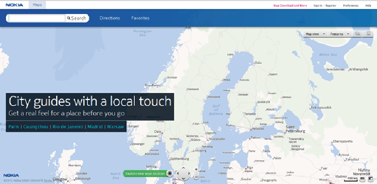
Figure 5
This is the Nokia maps homepage and as you can see here on the page it is made by Nokia.
Here are some things you can do with the Nokia maps website.
You can watch City pages of 50+ popular cities showing the local time and weather conditions, along with facts from Lonely Planet and suggested Places. There are integrated 3D maps for 25 cities, users on the page can search and route in 3D or 2D. You can watch the live traffic flow, public transport layer, and sync favorites with Nokia Maps on the web to your mobile phone. Heat maps show you which areas are popular for food, nightlife, shopping and local sights in some cities. Satellite maps is aviable to use. This site is very similar to Google maps.
So if you want to find a city that you are going to visit you can type the name of the city you want to look at in the search box.
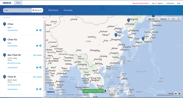
Figure 6
This figure shows the page that comes up when you have write in the city Chuo. So if you are going to fly to Japan or find out where Chuo is you will see that Chuo is on the top of the country. If you want to take a close look how Chuo looks like you can just zoom in on it, that you can see on this figure 7 thats below this text.
This figure shows the page that comes up when you have write in the city Chuo. So if you are going to fly to Japan or find out where Chuo is you will see that Chuo is on the top of the country. If you want to take a close look how Chuo looks like you can just zoom in on it, that you can see on this figure 7 thats below this text.
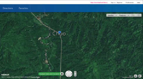
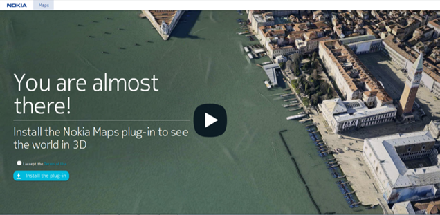
Figure 8
If you want to see the world IN 3D using Nokia Maps you will have to install the Nokia Maps plug-in.
If you want to see the world IN 3D using Nokia Maps you will have to install the Nokia Maps plug-in.
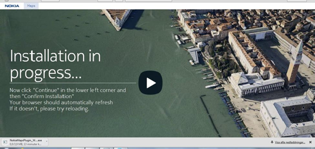
Figure 9
If you want to install the Nokia Maps plug-in this is how you do it. That little box in the left lower corner is the download process. when it has downloaded you click on it and run the file.
If you want to install the Nokia Maps plug-in this is how you do it. That little box in the left lower corner is the download process. when it has downloaded you click on it and run the file.
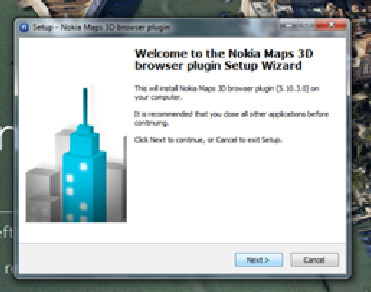
Figure 10
Here is the window that pop up after you have downloaded the program and clicked on the bar that was in the left lower corner. It is up to you to choose if you want to install the Nokia Maps 3D or not. If you want to press next-> and if you don’t want to press cancel.
Here is the window that pop up after you have downloaded the program and clicked on the bar that was in the left lower corner. It is up to you to choose if you want to install the Nokia Maps 3D or not. If you want to press next-> and if you don’t want to press cancel.
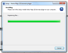
Figure 11
This page comes up when you have pressed next, and now it is installing.
When you want to use the Nokia Maps 3D you go into to the site and you click on Maps 3D after installing the plugin.
This page comes up when you have pressed next, and now it is installing.
When you want to use the Nokia Maps 3D you go into to the site and you click on Maps 3D after installing the plugin.
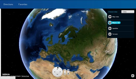
Figure 12
This page shows a 3D Map that I just downloaded. you can rotate with your mouse and see how the world looks like in 3D. There are limited areas that you can use your 3D map but new areas are added all the time.
This page shows a 3D Map that I just downloaded. you can rotate with your mouse and see how the world looks like in 3D. There are limited areas that you can use your 3D map but new areas are added all the time.
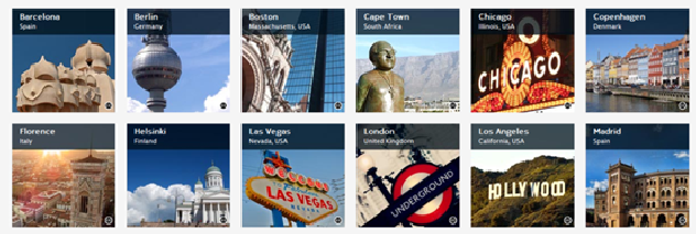
Here are all the cities that you can use the 3D Map in currently.
So I clicked on Stockholm Sweden and I wanted to look at the palace and this is what it looks like.
So I clicked on Stockholm Sweden and I wanted to look at the palace and this is what it looks like.
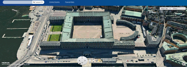
This is an amazing picture and it is very cool to use to see how different cities look like in 3D.
